Chinese engineers make sci-fi drone mapping reality
Share - WeChat


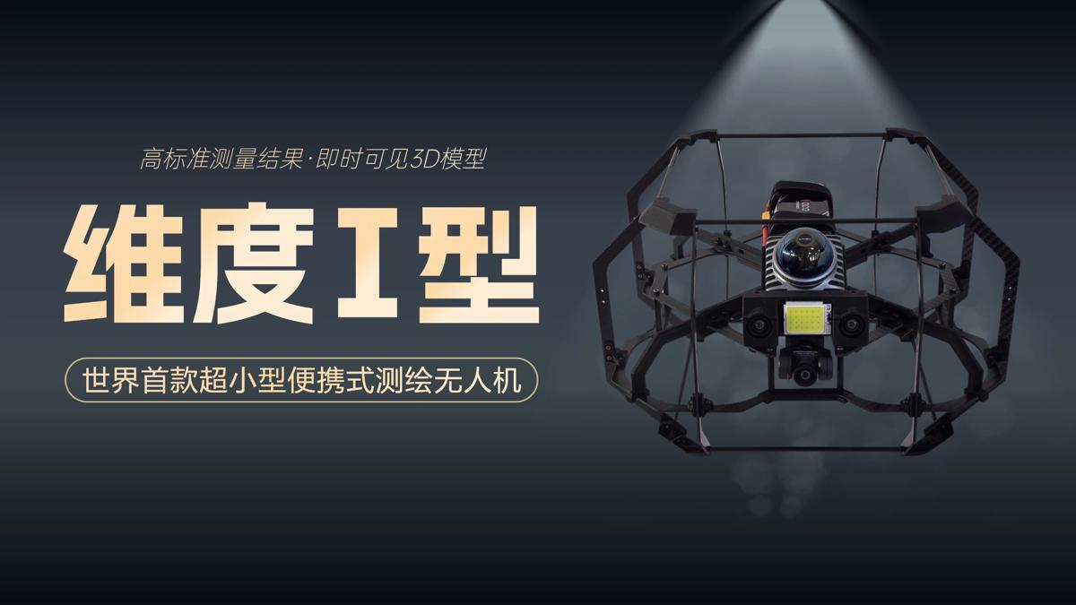
A scene from the science fiction film Prometheus, where explorers deploy a mini-drone that laser-scans caves to generate 3D models instantly, has turned into reality, thanks to the efforts of Chinese engineers.
On Tuesday, the Spatiotemporal AI Perception Technology Innovation Center at the Tianfu Jiangxi Laboratory in Chengdu, Sichuan province, announced that it has launched Dimension 1, the world's first ultra-compact portable mapping drone. It is designed to perform asset digitization scanning tasks in indoor environments.
- Crook: Unite Japanese people to prevent militarism
- SCO delegates explore Luban Workshop model in Tianjin
- International journalists hail SCO role in fostering development and stability
- Xi, Modi hold fruitful meeting: senior official
- Time to 'thank' friends who told China's story of resistance
- New blue book charts Chinese diplomacy in global affairs


